Defence has awarded $6.2 million to three Australian-based companies as part of the 2025 AUKUS…

SouthPAN satellite dish to enhance Australian GNSS accuracy
Construction of the first new Southern Positioning Augmentation Network (SouthPAN) satellite dish has begun at Lockheed Martin’s Telemetry Tracking and Command Station in Uralla, New South Wales.
SouthPAN improves positioning accuracy to as little as 10 centimetres which will help enable highly accurate manned and autonomous systems. It provides accurate, reliable and real-time positioning services across all of Australia and New Zealand’s land and maritime zones without the need for mobile phone or internet coverage. The overall investment is worth some $1.4 billion.
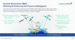
The program will use a unique, Lockheed Martin-developed, Second-Generation Satellite-Based Augmentation System (SBAS), broadcasting on two frequencies to augment signals from two Global Navigation Satellite Systems (GNSS), the US Global Positioning System (GPS) and the European Union’s Galileo system.
Lockheed Martin Australia was awarded the $1.18 billion prime contract to establish SouthPAN last year. The system is expected to be fully operational by 2028 and will be provided as a service for 19 years with an option to extend. The company has since signed a 20-year $187.4 million contract with Inmarsat Australia to host the satellite service on one of Inmarsat’s three new I-8 satellites from 2027. This will bring SouthPAN partners Geoscience Australia and Toitū Te Whenua Land Information New Zealand one step closer to a world-class satellite positioning service for the southern hemisphere.
An additional SouthPAN satellite service is also being procured. These satellite services will provide redundancy and resilience in SouthPAN that will ensure continuous broadcast of SouthPAN signals, enabling the development and use of critical applications relying on SouthPAN. These satellites will also be a critical part of a safety-of-life certified SouthPAN for aviation and other applications, scheduled for 2028. These services will be accessed or used by end users engaged in operations where life could be at risk, like landing an aircraft at an airport.
SouthPAN is a joint initiative between Geoscience Australia and Toitū Te Whenua Land Information New Zealand and will offer precise positioning accuracy at as little as 10 centimetres, a significant improvement on previous accuracy of 5 to 10 metres.
“Currently, SouthPAN uses existing ground infrastructure, allowing us to provide early open services while the new infrastructure is being built,” said Minister for Resources Madeleine King. “Having infrastructure solely dedicated to SouthPAN will provide important redundancy and resilience, which industry expect from accurate positioning services.”
“The new SouthPAN satellite service, along with SouthPAN’s ground infrastructure, will bring widespread benefits and a $6.2 billion economic injection to Australia alone, with the value anticipated to increase as new applications are developed,” said Ms Alison Rose, Chief of Space Division at Geoscience Australia.
Related Posts